Interactive World Maps Gpl Download
2,97 $
- Very cheap price & Original product !
- We Purchase And Download From Original Authors
- You’ll Receive Untouched And Unmodified Files
- 100% Clean Files & Free From Virus
- Unlimited Domain Usage
- Free New Version
- Product Version : 2.4.5
- Product Last Updated : 12.01.2020
- License : GPL
Interactive World Maps WordPress Plugin
Create Engaging Interactive World Maps
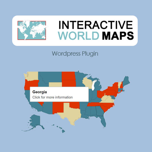
The Interactive World Maps WordPress plugin is a powerful tool that allows you to create and display interactive maps of the world on your website. With this plugin, you can showcase geographical information, travel destinations, data visualizations, and more in an engaging and user-friendly way.
Key Features of Interactive World Maps
Interactive World Maps offers a range of features to help you build captivating maps:
Customizable Map Design: Customize the look and feel of your world maps to match your website’s design. Choose from various map styles, colors, and map projections to create the desired visual appearance.
Interactive Regions: Divide the world map into regions and add interactivity to each region. Visitors can click on specific regions to view detailed information or navigate to associated pages.
Marker Support: Add markers to the map to pinpoint locations or highlight points of interest. Customize marker icons, labels, and tooltips to provide additional information to your visitors.
Customizable Tooltips: Display tooltips when users hover over regions or markers on the map. You can include images, descriptions, links, or any other content to provide detailed information about specific locations.
Interactive Legend: Create an interactive legend to provide a key for your map’s regions or markers. This helps users understand the meaning behind the different colors or symbols used on the map.
Data Visualization: Use the plugin’s built-in data visualization features to showcase statistical or numerical data on the map. You can assign colors or shades to different regions based on data values, making it easy for visitors to interpret the information.
Additional Features and Enhancements
Interactive World Maps includes additional features and enhancements to enhance the functionality and user experience:
Responsive Design: The maps created with Interactive World Maps are fully responsive, ensuring that they adapt to different screen sizes and devices.
Multiple Map Projections: Choose from a variety of map projections, including Mercator, Robinson, Miller, and more. This allows you to present the world map in different perspectives.
Custom Actions: Define custom actions for regions or markers, such as opening a lightbox, displaying additional information, or redirecting users to specific pages. This allows you to create interactive experiences tailored to your needs.
Tooltip Styling: Customize the style and appearance of tooltips to match your website’s design. You can modify colors, fonts, borders, and other visual elements.
Be the first to review “Interactive World Maps Gpl Download” Cancel reply
Related products
Plugin








Reviews
There are no reviews yet.